
Case Studies


Test area and application of algorithms
For the purpose of validating the proposed solution, this project will acquire primary data (coastline, intertidal topography, bathymetry, among others) in Babitonga Bay and Imbituba (Figure 1), on the north coast of the State of Santa Catarina (Brazil). This region has an estuarine complex with different uses, as well as a good database to validate the systems proposed here.
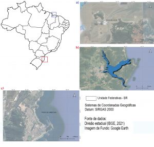
Figure 1. Study regions within Brazil. a) Praia do Amor, Maranhão, Brazil; b) Babitonga Bay, Santa Catarina, Brazil; c)Imbituba, Santa Catarina, Brazil (Source: Google Earth, 2023).
Primary databases are being added from other regions of Brazil, such as Praia do Amor on the west coast of São Luiz in Maranhão state (Figure 1).
Furthermore, data from coastal regions in the United States (Duck), Australia (Gold Coast), and Spain (Santo Ander), contributed by international collaborators of the project, will be utilized. Additionally, data from the Tauranga region, New Zealand (as depicted in Figure 5), are being collected for training purposes in the development of module 3.

Figure 2. Study area located in the Eastern region of the United States, in Duck, North Carolina (Source: Google Earth, 2023).
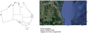
Figure 3. Study area in Gold Coast, Australia (Source: Google Earth, 2023).
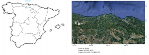
Figure 4. Study area located in the Northern region of Spain, in Santo Ander, Cantabria (Source: Google Earth, 2023).
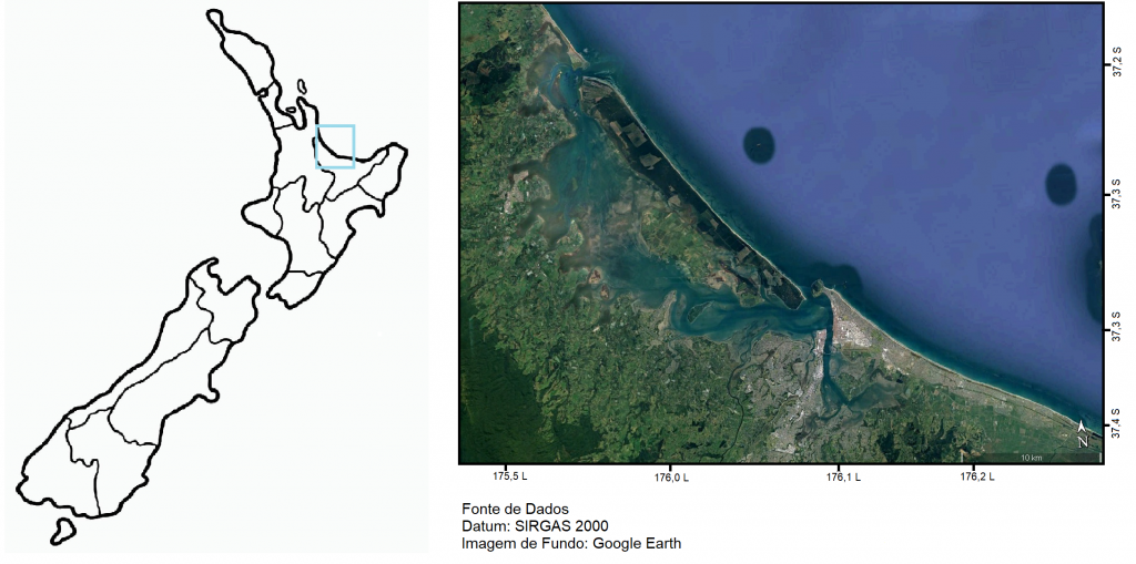
Figure 5. Study area located in the Northern region of New Zealand, Tauranga (Source: Google Earth, 2023).

